

 Share
Share Tweet
Tweet Pin It
 Send It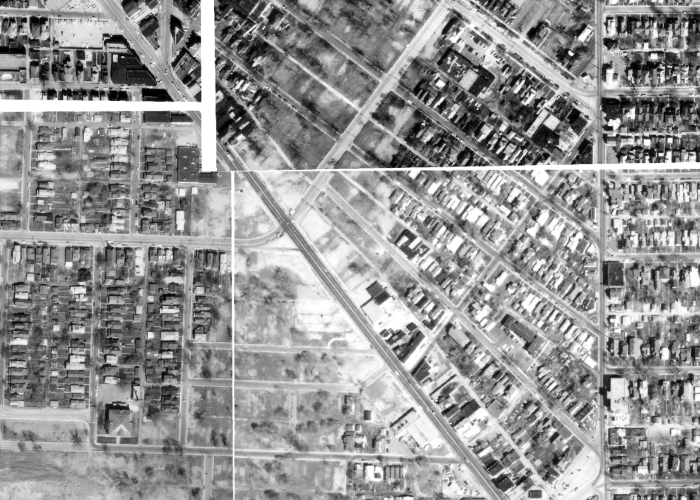
 All Photos
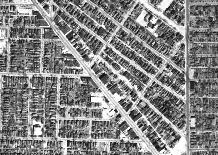
Following the Federal Highway Act of 1956, the State of Indiana announced it would design and build a freeway system connecting downtown Indianapolis to the growing national highway system. The State began purchasing properties in the early 1960s and was often met with much resistance from residents and businesses. The Indiana Department of Transportation, or INDOT, constructed the highway system downtown 1965-1975 with the system officially opening in 1976.
The construction of Interstate I-65/70 disrupted the continuous commercial corridor of Virginia Avenue and cut off Fountain Square from Fletcher Place and downtown. Homes, apartments, commercial buildings, churches, and schools were demolished for the construction of the innerloop interstate. Neighborhoods like the Old Northside, Cottage Home, Bates-Hendricks, and Fountain Square were divided from downtown. These neighborhoods were also disconnected and isolated from their adjacent neighborhoods, such as St. Joseph, Lockerbie Square, Babe Denny, and Fletcher Place. Entire blocks were erased. Thousands of people were displaced from their homes.
In the Fountain Square area alone, two blocks of Virginia Avenue, one block of Fletcher Avenue, and two blocks of Morris Street were all demolished, severing the commercial corridors. Over thirty blocks of the residential neighborhood were erased as well. These losses left a permanent mark on our community’s history. Resident Mary Vinci described in an 1989 newspaper: “I witnessed the area decline in the 1960s and 1970s with the construction of the interstate and inner loop system, which caused the demolition of numerous historic buildings. Previous to this, the esplanade along Fletcher Avenue was destroyed, against all petitions by the neighborhood citizens. Just in Fletcher Place alone we lost about ⅔ of the population of the area. Our beautiful Southside was ripped and torn apart: we flushed away many historical structures which were the early part of our city.”

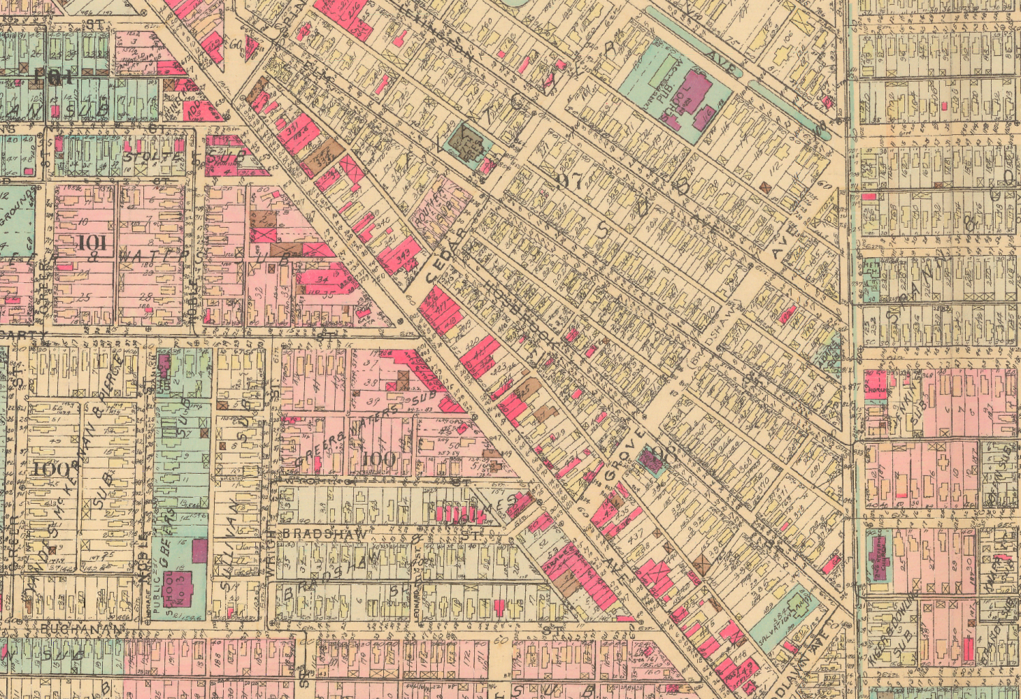
1941 Baist Map showing the neighborhood prior to the interstate.
Credit: 1941 Baist Map, MapIndy, City of Indianapolis, https://maps.indy.gov/MapIndy/.

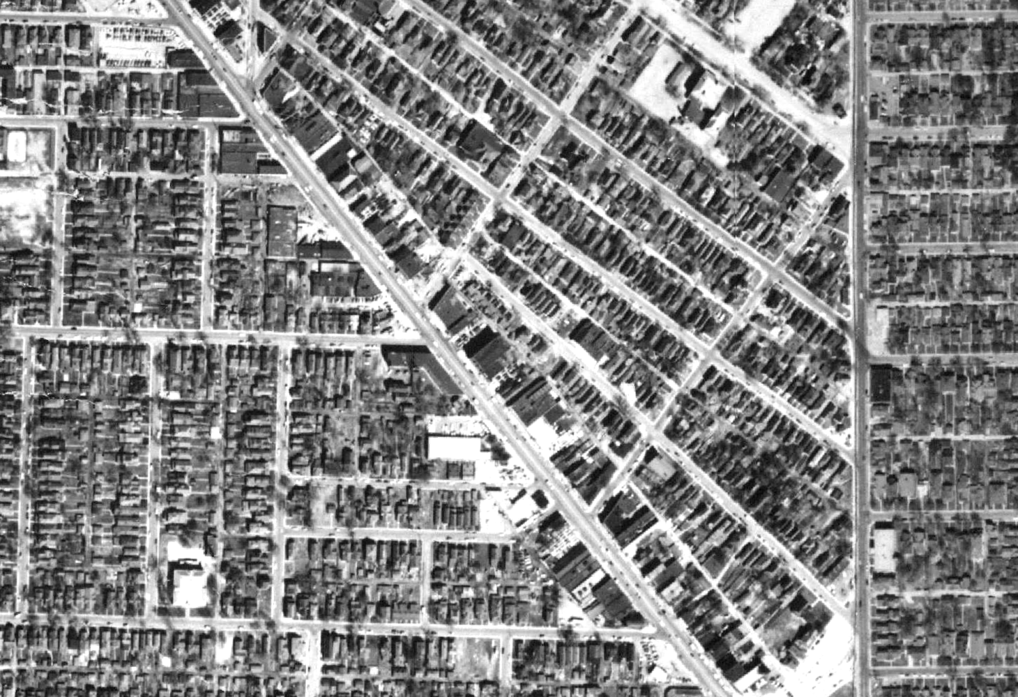
1956 Aerial photograph showing the neighborhood prior to the interstate.
Credit: 1956 Aerial Photograph, MapIndy, City of Indianapolis, https://maps.indy.gov/MapIndy/.
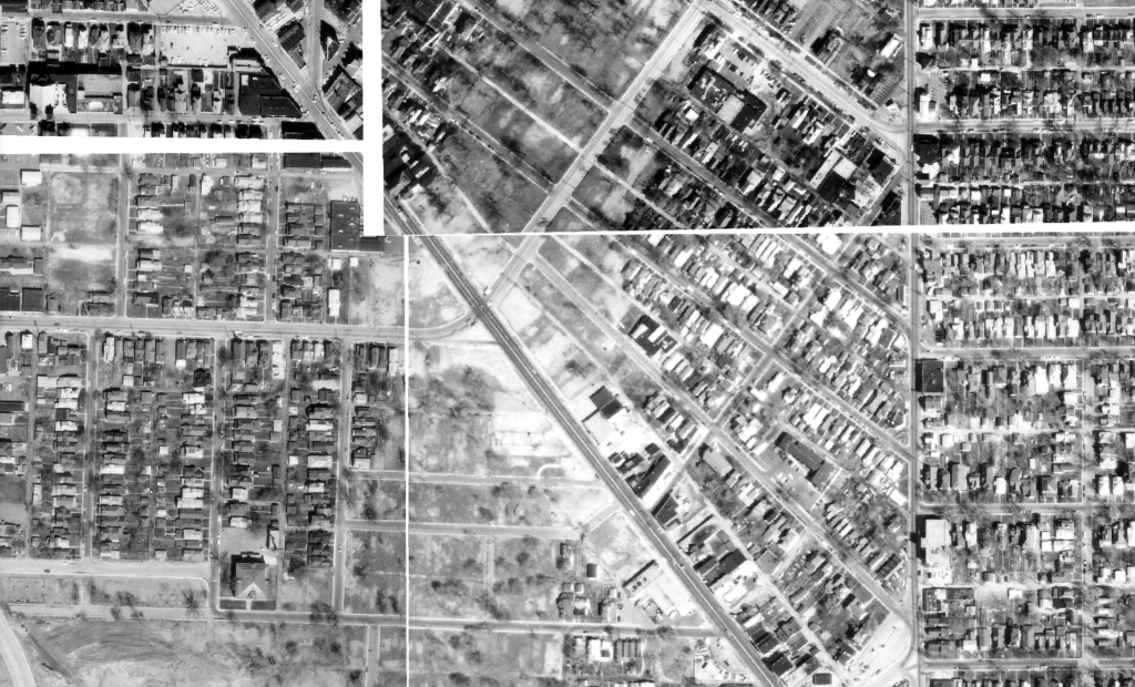
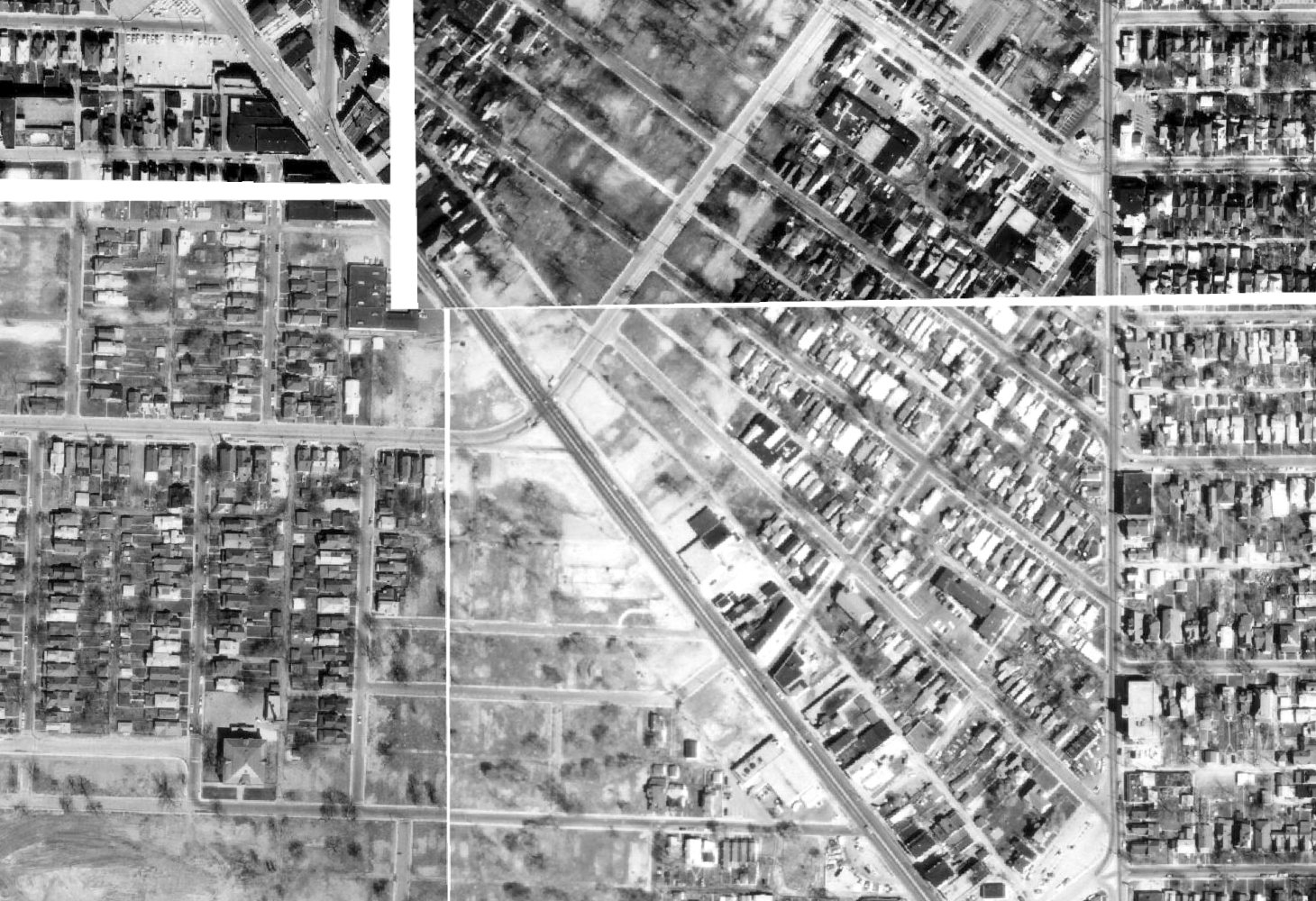
1972 Aerial photograph showing the neighborhood during land clearance during the interstate project.
Credit: 1972 Aerial Photograph, MapIndy, City of Indianapolis, https://maps.indy.gov/MapIndy/.
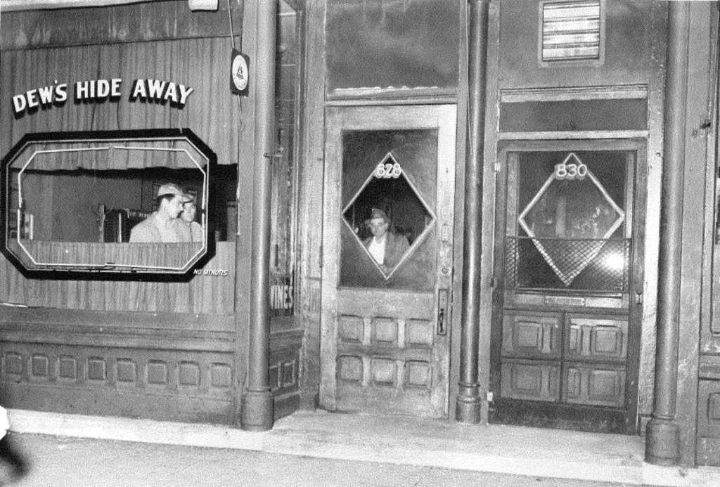
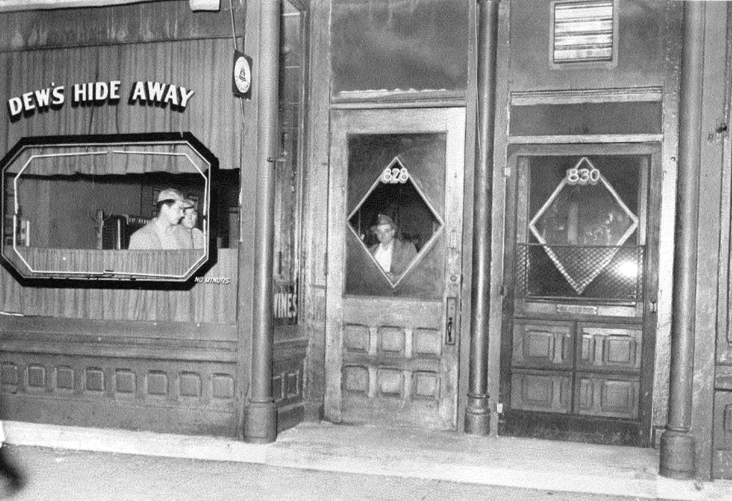
One of many buildings in the neighborhood demolished for the interstate. The Dew’s Hide Away tavern and restaurant at 828 Virginia Avenue.
Credit: Indianapolis Metropolitan Police Department Collection.
 Share
Share