

 Share
Share Tweet
Tweet Pin It
 Send It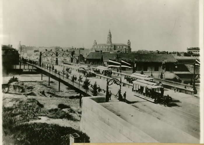
 All Photos
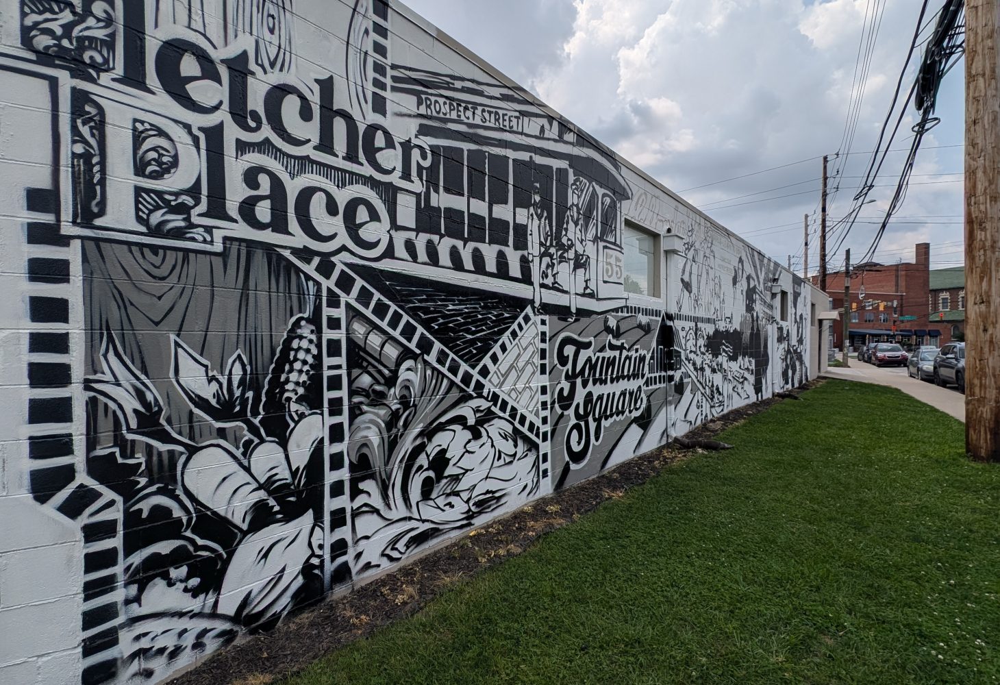
In 2024, muralist Dan “Handskillz” Thompson designed and painted the Fountain Fletcher District Association’s neighborhood history mural as part of an Indianapolis Neighborhood Resource Center’s Creative Placemaking grant. This mural serves as a moment to learn about neighborhood history through primary sources: historic photographs, newspaper clippings, portraits, and maps. Let’s take a closer look at some of the elements illustrated in the mural:
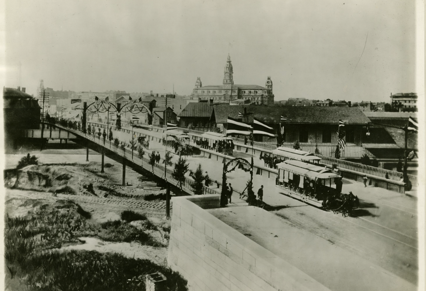
- The Viaduct: Pogue’s Run Creek and the railroad lines were a connectivity barrier for the near southeast side – at the intersection of Virginia Avenue and South Alabama Street. This resulted in both Fletcher Place and Fountain Square residents being somewhat isolated from the commercial activity of downtown. Our residents had to be resourceful, opening up their own businesses, shops, and services in the neighborhood to serve our community. Eventually to alleviate this, the Virginia Avenue Viaduct was built in the 1890s to carry Pogue’s Run and the railroad under Virginia Avenue, allowing those traveling on foot, bike, or streetcar to travel easily over these barriers and to downtown.
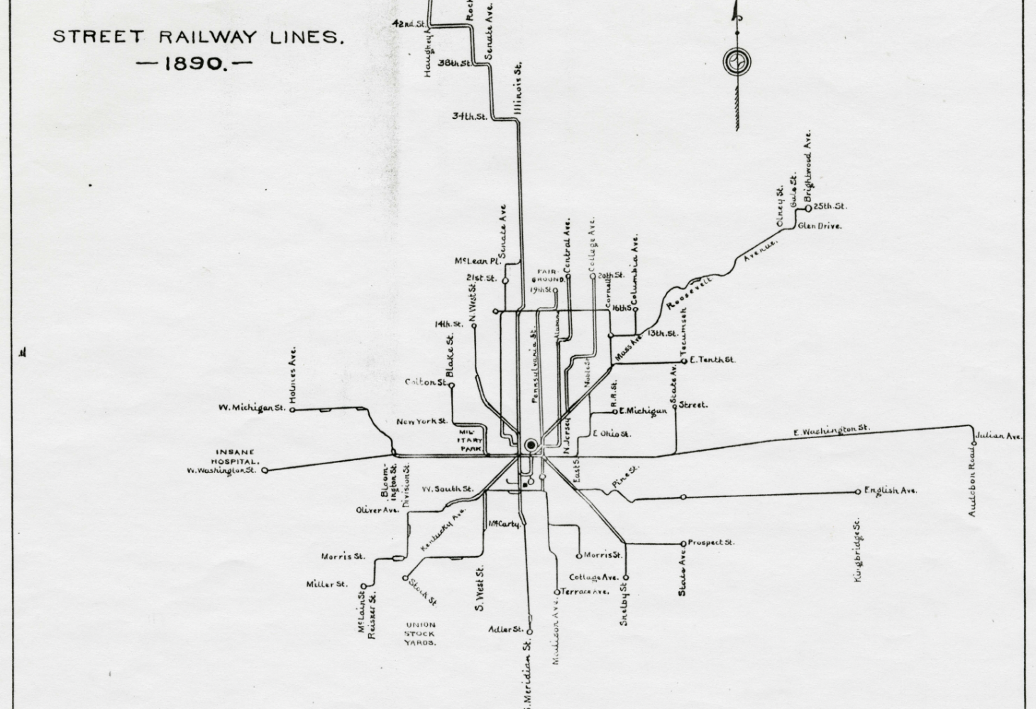
- Streetcar Travel: Indianapolis offered public transit prior to the bus in the form of a mule-drawn streetcar (1864-1894), the electric streetcar (1890-1953), and the trolleybus (1932-1957). The Citizens’ Street Railway line started in 1864 and served the growing neighborhood; the streetcar traveled down Virginia Avenue to the intersection of Shelby Street and Prospect Street, also known as “the end of the line” before turning back around and heading towards downtown. The streetcar system would expand as the city grew, particularly to the north and east.
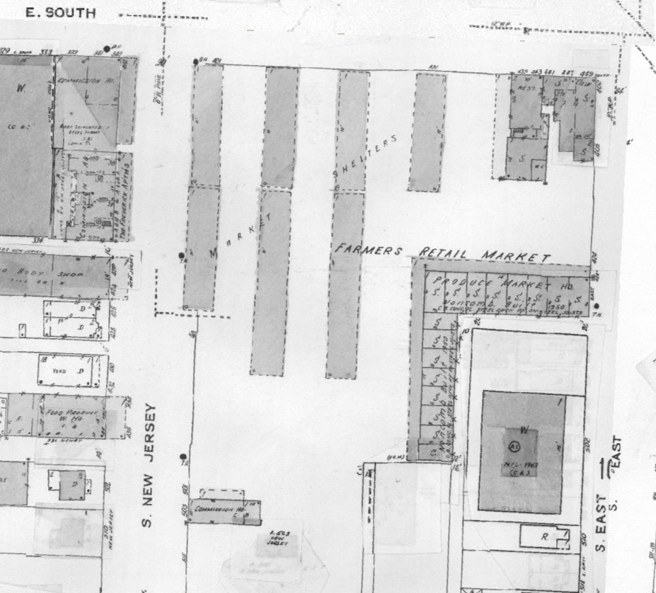
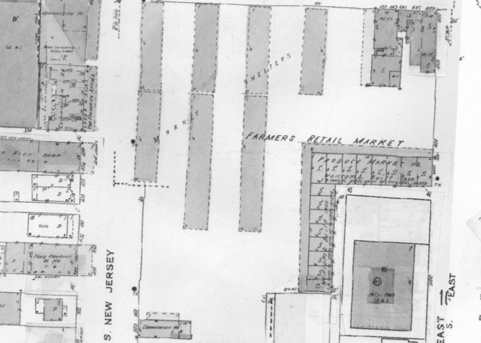
- Produce Market: The Indianapolis Growers Cooperative Association established a produce market in the 1920s at the area of South Street, South New Jersey Street, and Virginia Avenue, just to the west of Fletcher Place, or outside of the FFDA boundaries. This was a more convenient location for near southeast side merchants than City Market and allowed neighborhood merchants to sell their produce, meat, and other greenhouse goods. Many Germans worked in the produce and meat industries; Italians worked in the produce industry; and Dutch and Germans worked in the south side greenhouse industry. This produce market served the diverse communities of the south and southeast sides – German, Italian, Dutch, Jewish, Middle Eastern – until it closed in the late 1980s.
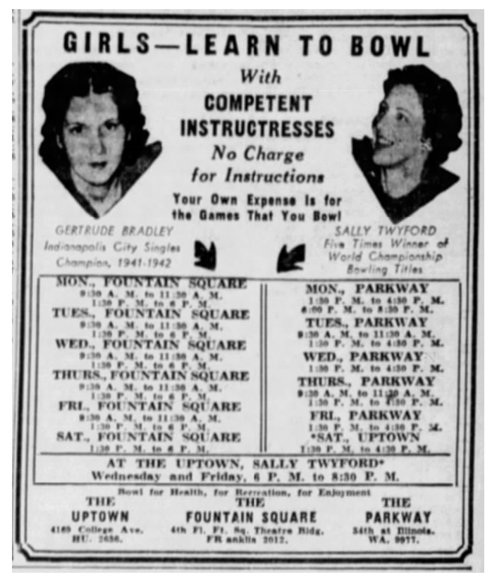
- Women’s Bowling: Bowling leagues were a popular social activity in the mid-20th century. The Fountain Square Theatre Building provided two spaces for bowling and was a popular place for leagues and for introductory classes. Bowling teams were organized through workplaces, community groups, churches, and so on and competed within the city and with leagues in other cities. The Triangle Women’s Bowling League played often at the Theater Building.
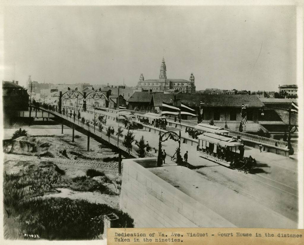
Completed viaduct looking north towards downtown, with the Marion County Courthouse in the background.
Credit: “Virginia Avenue viaduct, courthouse and other features sketched in, scene from 1890s,” W. H. Bass Photo Company Collection, Indiana Historical Society.
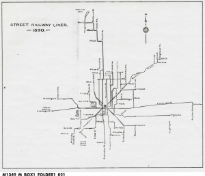
1890 Streetcar Line Map, showing the line down Virginia Avenue to Prospect Street and Shelby Street.
Credit: “Indianapolis Railways Trolley Lines, 1864-1921,” Indianapolis Transit Companies Papers, Indiana Historical Society.
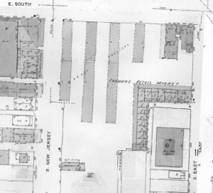
1956 Sanborn Map of the Produce Market.
Credit: MapIndy, City of Indianapolis.
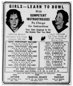
Advertisement for bowling classes.
Credit: Advertisement, Indianapolis Star, 2/6/1943.
Back to Tour
 Share
Share